mapas
a continuación se muestran mapas que muestran los territorios tradicionales o límites de las reservas.
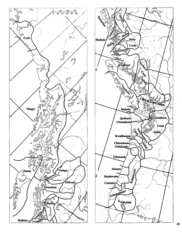
Handbook of North American Indians. V. 7: Northwest Coast
editado por Wayne Suttles. Washington: Smithsonian Institution, 1990.

Southern Coast Salish Territories
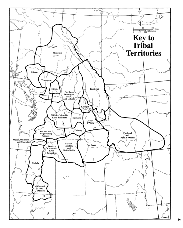
«Plateau: Key to Tribal Territories»
Handbook of North American Indians. V. 12: Plateau editado por Deward W. Walker, Jr. Washington: Smithsonian Institution, 1998.,

Plateau: Key to Tribal Territories
«The Nez Perce Homeland and Their Neighbors»
Nez Perce Coyote Tales: The Myth Cycle.By Deward W. Walker, Jr. Norman: University of Oklahoma Press, 1998, p. 6.

The Myth Cycle
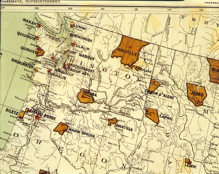
Northwest portion of » Map showing Indian Reservations within the limits of the United States compiled under the direction of the Hon.T. J. Morgan, Commissioner of Indian Affairs.»U. S. Census Office. Censo 11. 1890, V.10 sigue la página 34, Censo de 1890.,

reservas indias en el noroeste
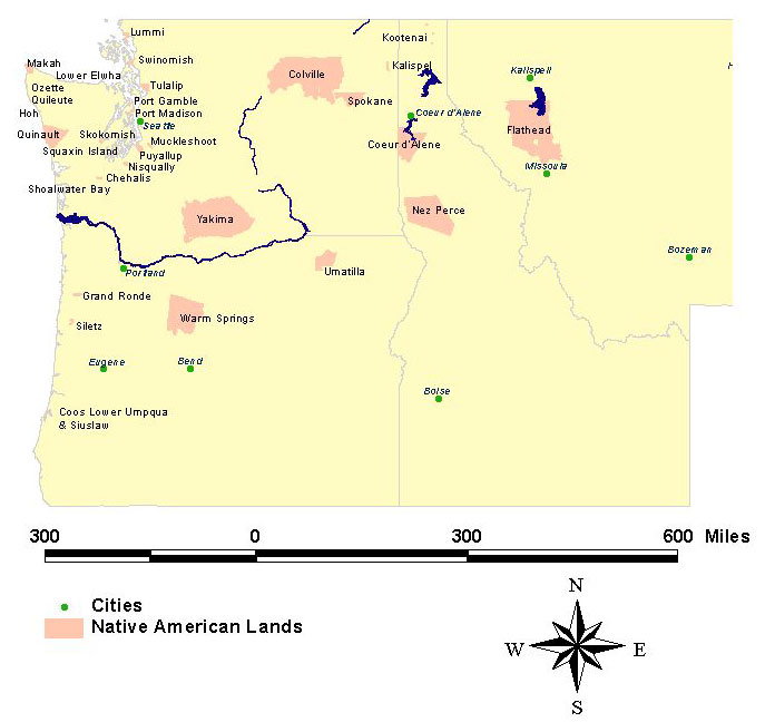
reservas indias contemporáneas de Grupos culturales de la costa noroeste y la meseta

reservas contemporáneas
Territorios nativos del sudeste de Alaska

Southeast Alaska Native Territories
Los siguientes mapas fueron escaneados del volumen de 1879 de la oficina de Asuntos Indios de los Estados Unidos.,he Secretary of the Interior:
![]() Grand Ronde Reserve, Oregon
Grand Ronde Reserve, Oregon
![]() Lummi Reserve/Swinomish Reserve
Lummi Reserve/Swinomish Reserve
![]() Nisqually Agency; Nisqually and Chehalis Reserves
Nisqually Agency; Nisqually and Chehalis Reserves
![]() Puyallup Reserve/Muckleshoot Reserve
Puyallup Reserve/Muckleshoot Reserve
![]() Shoalwater Reserve
Shoalwater Reserve
![]() Siletz Reserve, Oregon
Siletz Reserve, Oregon
![]() Skokomish Reserve/Squaxin Island Reserve
Skokomish Reserve/Squaxin Island Reserve
![]() Tulalip Reserve/Port Madison Reserve
Tulalip Reserve/Port Madison Reserve